• English
    • العربية
  • العربية
  • Login
  • QU
  • QU Library
  •  Home
  • Communities & Collections
View Item 
  •   Qatar University Digital Hub
  • Qatar University Institutional Repository
  • Academic
  • University Publications
  • QU Forum Proceedings
  • Qatar University Annual Research Forum & Exhibition
  • QUARFE 2021
  • Theme 1: Energy and Environment
  • View Item
  • Qatar University Digital Hub
  • Qatar University Institutional Repository
  • Academic
  • University Publications
  • QU Forum Proceedings
  • Qatar University Annual Research Forum & Exhibition
  • QUARFE 2021
  • Theme 1: Energy and Environment
  • View Item
  •      
  •  
    JavaScript is disabled for your browser. Some features of this site may not work without it.

    Oil Spill Index (OSI) to Sentinel-2 satellite data: QU in International Contribution

    Thumbnail
    View/Open
    250.pdf (838.4Kb)
    Date
    2021
    Author
    Rajendran, S
    Fahad, AS
    Sadooni, FN,
    Al-Kuwari, HAS
    Vethamony, P
    Anisimov, O
    Nasir, S
    Al-Khayat, J
    Govil, H
    Seegobin, VO
    ...show more authors ...show less authors
    Metadata
    Show full item record
    Abstract
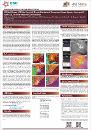
    An Oil Spill Index (OSI = (B3+B4)/B2) was developed and applied to Sentinel-2 optical satellite data of the European Space Agency (ESA) to map marine oil spills using spectral absorption characters of spectral bands of the Sentinel-2. The potential application of OSI and derived indices [i. (5+6)/7, (3+4)/2, (11+12)/8 and ii. 3/2, (3+4)/2, (6+7)/5] were demonstrated to the oil spills that occurred off Mauritius, Indian Ocean, on August 06, 2020, and Norilsk region, Russia on May 29, 2020, and the results were published in the peer-reviewed research journals. Recently (August 19, 2021), our methodology was recognized by the Sentinel-Hub (a repository of custom scripts) https://custom-scripts.sentinel-hub.com/sentinel-2/oil-spill-index/ for OSI calculation. We validated the remote sensing results with the drone images taken during the incident. Our OSI index is the first to be applied to Sentinel-2 optical data to map oil spills. We proved the potential of indices and the capability of Sentinel sensors to detect, map, monitor, and assess the oil spill, which can be used for emergency preparedness of oil spills.
    URI
    https://doi.org/10.29117/quarfe.2021.0020
    DOI/handle
    http://hdl.handle.net/10576/24287
    Collections
    • Marine Science Cluster [‎215‎ items ]
    • Theme 1: Energy and Environment [‎73‎ items ]

    entitlement


    Qatar University Digital Hub is a digital collection operated and maintained by the Qatar University Library and supported by the ITS department

    Contact Us | Send Feedback
    Contact Us | Send Feedback | QU


    Home

    Submit your QU affiliated work

    Browse

    All of Digital Hub
      Communities & Collections Publication Date Author Title Subject Type Language Publisher
    This Collection
      Publication Date Author Title Subject Type Language Publisher

    My Account

    Login

    Statistics

    View Usage Statistics

    Qatar University Digital Hub is a digital collection operated and maintained by the Qatar University Library and supported by the ITS department

    Contact Us | Send Feedback
    Contact Us | Send Feedback | QU


    Video