• English
    • العربية
  • English
  • تسجيل الدخول
  • جامعة قطر
  • مكتبة جامعة قطر
  •  الصفحة الرئيسية
  • الوحدات والمجموعات
  • المساعدة
    • إرسال الأعمال الأكاديمية
    • سياسات الناشر
    • أدلة المستخدم
    • الأسئلة الأكثر تكراراً
  • عن المستودع الرقمي
    • الرؤية والرسالة
عرض التسجيلة 
  •   مركز المجموعات الرقمية لجامعة قطر
  • المستودع الرقمي لجامعة قطر
  • أكاديمية
  • إصدارات جامعة قطر
  • وقائع المنتديات
  • المنتدى والمعرض البحثي السنوي لجامعة قطر
  • QUARFE 2020
  • Theme 1: Energy, Environment & Resource Sustainability
  • عرض التسجيلة
  • مركز المجموعات الرقمية لجامعة قطر
  • المستودع الرقمي لجامعة قطر
  • أكاديمية
  • إصدارات جامعة قطر
  • وقائع المنتديات
  • المنتدى والمعرض البحثي السنوي لجامعة قطر
  • QUARFE 2020
  • Theme 1: Energy, Environment & Resource Sustainability
  • عرض التسجيلة
  •      
  •  
    JavaScript is disabled for your browser. Some features of this site may not work without it.

    Assessment of Urban Heat Islands Based on the Relationship Between Land Surface Temperature and Land Use/Land Cover in Greater Doha

    Thumbnail
    عرض / فتح
    ASSESSMENT OF URBAN HEAT ISLANDS BASED ON THE RELATIONSHIP BETWEEN LAND SURFACE TEMPERATURE AND LAND USELAND COVER IN GREATER DOHA.pdf (7.073Mb)
    التاريخ
    2020
    المؤلف
    Siddiqui, Simil Amir
    البيانات الوصفية
    عرض كامل للتسجيلة
    الملخص
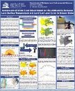
    Urban heat islands (UHI) are areas with elevated temperatures occurring in cities compared to surrounding rural areas. This study realizes the lack of research regarding the trends of UHIs in desert countries and focuses on Doha. The research includes twelve months of two-time periods; 2000-2019. ArcGIS software was used to compute the land surface temperature (LST) of the city using Landsat images. Land use/land cover (LULC) maps were computed to show how the city has evolved in 19 years. 30 field samples were used to verify the accuracy of the LULC. Results showed UHI in Doha did not display similar pattern to that of cities in subtropical and temperate regions. Higher temperatures were prevalent in out-skirts comprising of barren and built-up areas with high population and no vegetation. Comparatively, the main downtown with artificially planted vegetation and shade from skyscrapers created cooler microclimates. The overall LST of greater Doha has increased by 0.7°C from 2000 to 2019. Furthermore %LULC of built up, vegetation, barren land, marsh land and water body were 29%, 4.5%, 58.6%, 2.8% and 5% in 2000 and 56.5 %, 8.2%, 33.2 %, 0% and 2.1% in 2019 respectively. Overall there was an increase in built-up and vegetation, decrease in water and barren areas and complete loss of marsh land. Highest temperatures were recorded for marsh land area in year 2000 and barren and built in year 2019. Transect profiles showed positive correlation between NDBI and LST and a negative correlation between NDVI and LST.
    معرّف المصادر الموحد
    https://doi.org/10.29117/quarfe.2020.0108
    DOI/handle
    http://hdl.handle.net/10576/16643
    المجموعات
    • Theme 1: Energy, Environment & Resource Sustainability [‎108‎ items ]

    entitlement


    مركز المجموعات الرقمية لجامعة قطر هو مكتبة رقمية تديرها مكتبة جامعة قطر بدعم من إدارة تقنية المعلومات

    اتصل بنا | ارسل ملاحظاتك
    اتصل بنا | ارسل ملاحظاتك | جامعة قطر


    الصفحة الرئيسية

    أرسل عملك التابع لجامعة قطر

    تصفح

    محتويات مركز المجموعات الرقمية
      الوحدات والمجموعات تاريخ النشر المؤلف العناوين الموضوع النوع اللغة الناشر
    هذه المجموعة
      تاريخ النشر المؤلف العناوين الموضوع النوع اللغة الناشر

    حسابي

    تسجيل الدخول

    إحصائيات

    عرض إحصائيات الاستخدام

    عن المستودع الرقمي

    الرؤية والرسالة

    المساعدة

    إرسال الأعمال الأكاديميةسياسات الناشرأدلة المستخدمالأسئلة الأكثر تكراراً

    مركز المجموعات الرقمية لجامعة قطر هو مكتبة رقمية تديرها مكتبة جامعة قطر بدعم من إدارة تقنية المعلومات

    اتصل بنا | ارسل ملاحظاتك
    اتصل بنا | ارسل ملاحظاتك | جامعة قطر


    Video